Real estate photography

Real Estate Drone Photography in London, Ontario

Attract serious buyers, generate quality inquiries, and close listings faster with drone photography in London, Ontario.

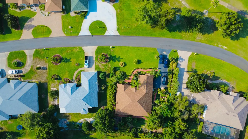
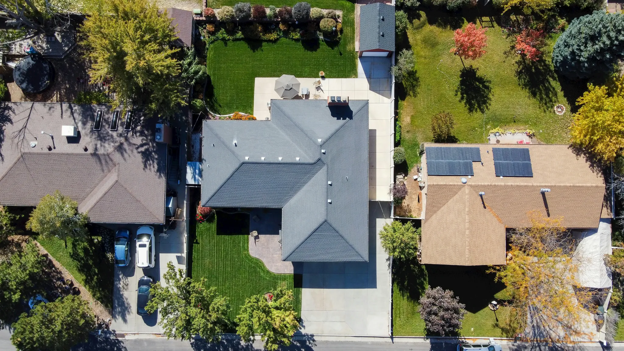
Top down aerial view of a large residential property

Aerial photography

Drone Photography Services
Built to Sell Listings Faster.

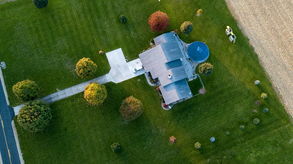
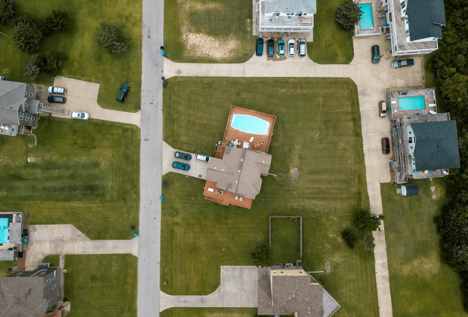
Top-down aerial photo of a rural property with a pool

Drone Photography

High-resolution real estate photography in London, Ontario that showcases lot size, layout, surroundings, and property context from above.

  • Aerial property photography that shows what ground shots miss.
  • MLS-ready files optimised for marketing and social media.
  • Stronger first impressions that drive more buyer inquiries.
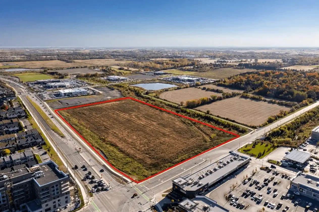
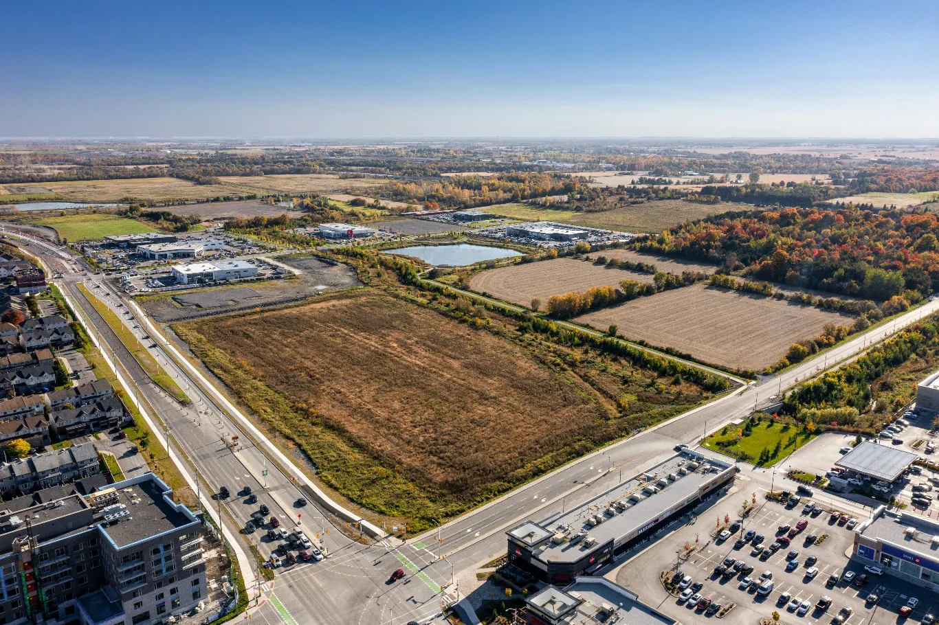
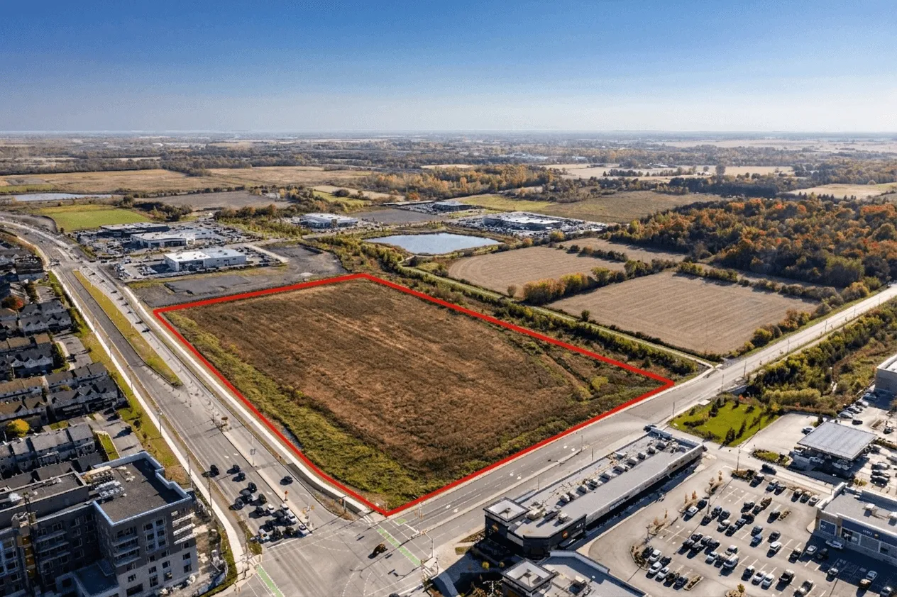
Aerial photo of a development lot with its boundary outlined in red

Property Outlining

Property outlining in London, Ontario to precisely highlight lot lines, boundaries, and property dimensions.

  • Accurate boundary visualisation for buyer confidence.
  • Competitive edge for land marketing and development proposals
  • Clear context for property dimensions and lot coverage

Why Agents Trust Forest City Aerial for Real Estate Drone Photography in London, Ontario

24-Hour Delivery

Fast turnaround on real estate drone photography and listing video so you can launch listings without delays.

Premium Quality

High-resolution aerial media captured by an experienced drone photographer in London, Ontario. Professionally edited and delivered ready for MLS and marketing.

Certified Pilots

Fully certified drone operators in London, Ontario providing compliant real estate drone photography in accordance with Transport Canada regulations and safety standards.

Build Confidence

Premium presentation through professional aerial photography and a polished real estate listing website helps you stand out and strengthen your brand.

customer reviews

“The aerial photos and video completely changed how my listings performed. I had a property sit for three weeks with standard photos. We reshot with Forest City Aerial and it was under offer in four days. The quality speaks for itself.”

Sarah Mitchell Past Client

“I've used drone photography on several listings now and the results are consistent: better first impressions, more showings, and stronger offers. Forest City Aerial delivers fast, the media is polished, and it's genuinely helped my brand stand out in London.”

Amanda Firth Past client

“The turnaround is what sold me. I booked the shoot, had edited aerial photos and video back within 24 hours, and launched the listing the next morning. That kind of speed without sacrificing quality makes a real difference when timing matters.”

James Thorton Past client

Backed by data

Data-Driven
Performance.

Real estate drone photography consistently delivers stronger buyer interest, more inquiries, and faster sales.

Professionally photographed properties can sell up to 2% higher relative to list price.

Source: Redfin, 2013

2%

Listings that include video receive up to 4x more inquiries.

Source: REA Group, 2012

4x

Over 80% of home buyers prioritize photos when searching online.

Source: NAR, 2025 Profile of Home Buyers and Sellers

80%

Listings Sell up to 68% Faster With
Real Estate Drone Photography.

Sources: Redfin, 2013REA Group, 2012NAR, 2025 Profile of Home Buyers and SellersRubyHome, citing MLS data

Our process

A Structured Approach to
Real Estate Drone Photography.

We review property details and goals to capture aerial media with purpose, not just aesthetics.

Photos are edited and formatted specifically for MLS, social media, and digital marketing.

Edited aerial photos delivered within 24 hours, ready to launch your listing the next day.

Pricing

One Shoot. Three Ways to Book It.

Certified pilots and MLS-ready files on every package, with 24-hour delivery on most.

Photo

$249

Per listing

Aerial stills, top-down and angled, sized for every MLS portal.

Book photo

Full Package

$699

Per listing

All the aerial media, plus a dedicated listing website with lead capture.

Book full package

Prices before HST · London, Ontario and surrounding areas

Help & Support

Frequently Asked
Questions

Answers to common questions about real estate drone photography pricing, turnaround times, and how our drone photography services work in London, Ontario.

Packages for real estate drone photography in London, Ontario start at $249. Final pricing depends on property size, location, and whether you need photos, video, or both. Every shoot includes professional editing and delivery in an MLS-ready format. Reach out with your property details for a quick, tailored quote.

Photos are delivered within 24 hours of your shoot, fully edited, formatted for MLS, and ready to publish. 24-hour delivery is built into our drone photography services, so you can list sooner and keep momentum on properties where timing matters most.

Yes. Every flight is conducted by a Transport Canada certified pilot, operating in full compliance with Canadian airspace and safety regulations. Certification means your listing is handled by a qualified drone photographer, not a hobbyist, which protects you, the homeowner, and the property.

No. We do not fly in rain or snow, both for flight safety and to protect the quality of your media. Weather shifts quickly, and drone photography has real limits in poor conditions. If conditions force us to postpone, we reschedule at no additional cost. You will not lose your booking or pay twice for a reshoot.

Our drone photography services cover London, Ontario and surrounding communities within approximately 30 minutes. That includes St. Thomas, Woodstock, Tillsonburg, Aylmer, Port Stanley, Belmont, Dorchester, Thorndale, Ilderton, Lucan, Komoka, Kilworth, Mount Brydges, and Delaware. Nearby locations outside this range can often be accommodated on request. Get in touch if you are not sure whether we cover your property.

Aerial only. We focus exclusively on aerial drone photography, which means every shoot is led by a certified drone photographer using professional equipment, with full attention on aerial composition, lot context, property outlining, and cinematic movement. For interior property photography, we recommend pairing our aerial work with a trusted local real estate photographer, and we are happy to refer one if you need it.

Book now

Ready to Elevate
Your Listing?

Set your listing up to make a strong impression. Send the details and we’ll outline a simple plan to get started.